Airborne exploration campaigns
A detailed understanding of the subsurface is an essential step in any geothermal heat and lithium production project. That’s why, since 2022, Lithium de France has been conducting exploration campaigns drawing on the finest technical and scientific expertise. With a total area of 750 km² explored and an investment of over €12 million, Lithium de France, a subsidiary of Arverne, stands out as the French operator to have explored such a large area.
What is an aerial exploration campaign?
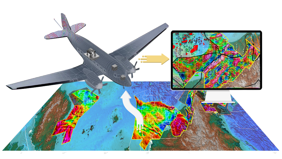
An aerial exploration campaign involves gathering information on the properties of underground rocks using an aircraft equipped with on-board technology capable of measuring geological properties that are invisible to the naked eye.
Aerial surveys make it possible to cover vast areas in a short space of time, without being constrained by the terrain. This approach relies on passive measurements recorded from the aircraft.
The data collected in this way complements the historical data we have, drawn from the rich oil history of Northern Alsace, and the data acquired through previous exploration campaigns conducted within the boundaries of our Exclusive Exploration Licences (PER). This data is used to produce geological maps and models that aid in the identification and characterisation of geothermal heat and lithium resources.
Geophysical data, which enters the public domain ten years after acquisition, also contributes to the expansion of our collective knowledge of the subsurface.
What is being measured?
The technique used is based on two on-board measurements:
- The first, known as Full tensor Gradiometry (FTG), involves measuring differences in the density of underground rocks in other words, how “compact” or “light” they are. Highly sensitive equipment is installed on an aircraft that flies over the area to be studied. In flight, these instruments detect three-dimensional variations in the Earth’s gravitational field caused by differences in density between rock types. For example, dense rocks such as granite exert a slightly stronger gravitational pull than lighter rocks such as sandstone. Fluctuations in the measurements thus enable the detection of various geological structures.
- The second method, known as magnetometry, involves measuring variations in the Earth’s natural magnetic field, which depend on the nature of the rocks present in the subsurface. Certain rocks can retain a magnetisation acquired during their formation at high temperatures: the minerals they contain align themselves with the direction of the Earth’s magnetic field at that moment, an orientation that is maintained as the rock cools. Analysing these magnetic variations thus makes it possible to highlight contrasts in the subsurface and to identify the main types of rock present, for example, sedimentary rocks or those resulting from past volcanic activity.
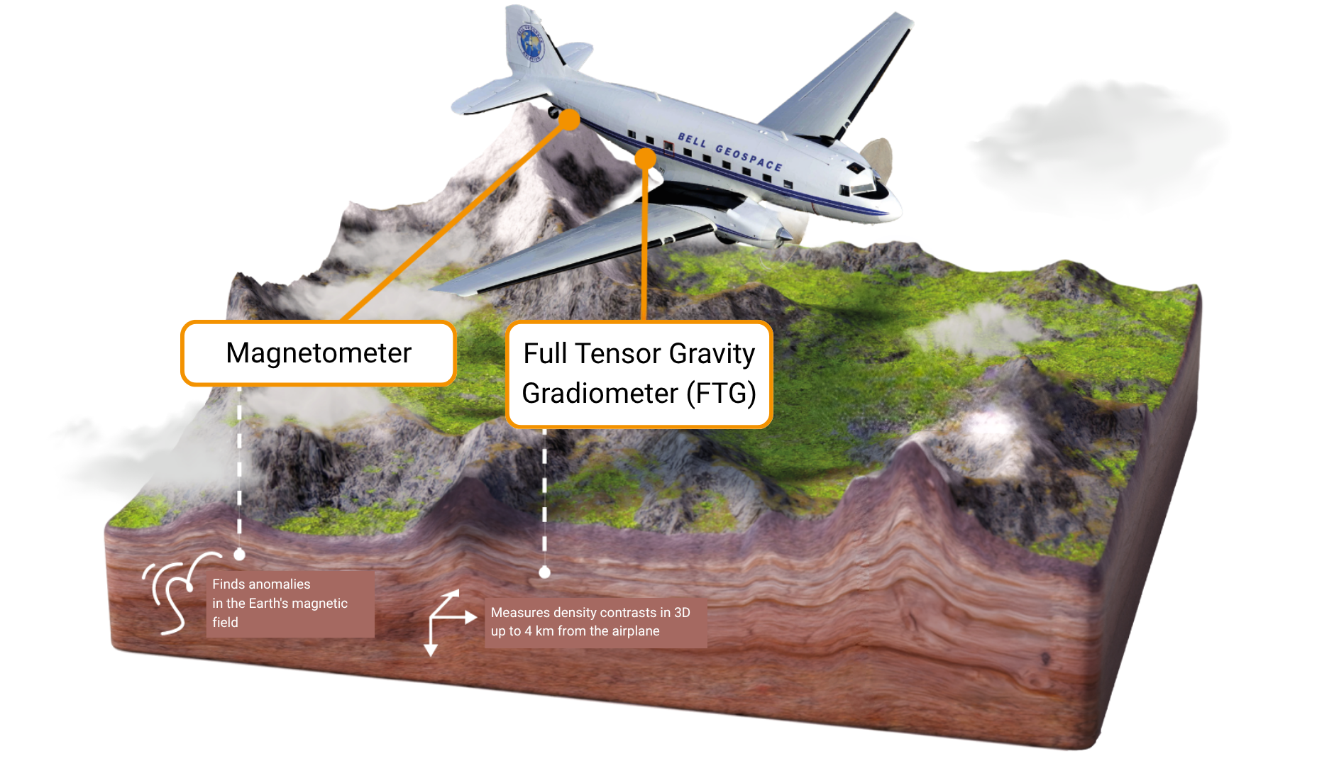
By combining the data collected using these two methods, we obtain a 3D map of the subsurface. This helps our geoscience experts to deepen our understanding of the nature and structure of the formations beneath the surface.
The 2026 Aerial Exploration Campaign
Where? In 2026, an airborne geological survey will be carried out over the area covered by our Exclusive Exploration Licences (PER). The aircraft flies at a minimum altitude of 270 metres. It is based at Speyer Airport (Germany, Rhineland-Palatinate) and moves to a different area each day.
When will the flights take place? The campaign lasts one to two weeks, depending on weather conditions, which may cause delays or cancellations. Flights take place during the day.
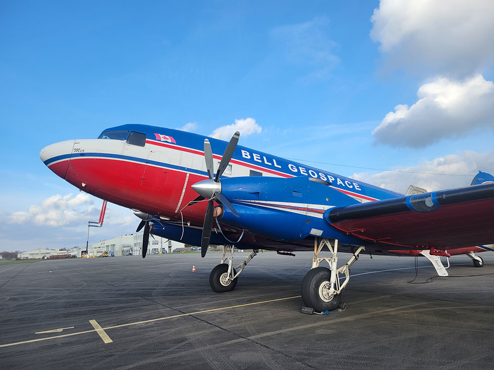
Who is carrying out the campaign? The surveys are being carried out by Bell Geospace, an airborne geophysical survey company. It owns and operates three aircraft specially fitted out for geological mapping. With over 25 years’ experience in geophysical surveys, it has a wide range of expertise gained in many different countries and contexts.
Photo credits: Thomas Fraszczak, Bell Geospace, Lithium de France.