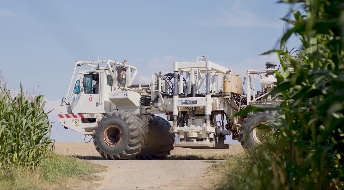
Land geophysical exploration using vibroseismic trucks
A detailed understanding of the subsurface is an essential step in any geothermal heat and lithium production project. That’s why, since 2022, Lithium de France has been conducting exploration campaigns drawing on the finest technical and scientific expertise. With a total area of 750 km² explored and an investment of over €12 million, Lithium de France, a subsidiary of Arverne, stands out as the French operator to have explored such a large area.
What is a land geophysical exploration campaign using vibroseismic trucks?
A 3D exploration campaign using trucks equipped with acoustic wave transmitters is a non-intrusive geophysical survey method that provides a better understanding of the subsurface structure within a defined area and over a given period. This technique relies on the use of truck fitted with a vibrating plate which, when brought into contact with the ground, generates acoustic waves that propagate through the subsurface. As they encounter different geological layers, these waves are reflected or refracted depending on the characteristics of the ground they pass through. This method is based on the principle of seismic reflection and is widely used to obtain a precise image of underground structures without the need for drilling.
What is being measured?
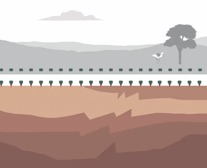
The waves emitted by the trucks are captured by geophones, small sensors arranged in a precise grid pattern across the entire study area. These sensors measure both the waves emitted directly and their echoes after reflection or refraction within the subsurface. Analysis of the collected signals enables the reconstruction of a detailed 3D map of deep geological structures. This data is then interpreted to identify areas suitable for geothermal heat production and the presence of geothermal lithium. The vibrations generated at the surface are limited and subject to rigorous monitoring: their levels are checked before and during operations to ensure compliance with regulatory thresholds near residential areas.
From installation to data collection: the 5 phases of the campaign
Coordinated by a partner firm (this phase is known as "permitting").
To identify the locations of the geophones and the emission points.
Several thousand geophones are deployed at regular intervals.
Deployment of sound-emitting trucks in the affected area (duration: 15 days).
All temporary equipment is collected (duration: 7 days).
Any questions?
Photo credits: Lithium de France.